
Acupuncturist Crystal hikes the Nootka Trail in 2025 (Part 1)
The following was written by our Acupuncturist Crystal Gilhooly, who hiked the Nootka Trail. Read on to learn more about the trail, preparations, and how to reduce the chance of injury. It is written entirely in her own words, and not by AI.
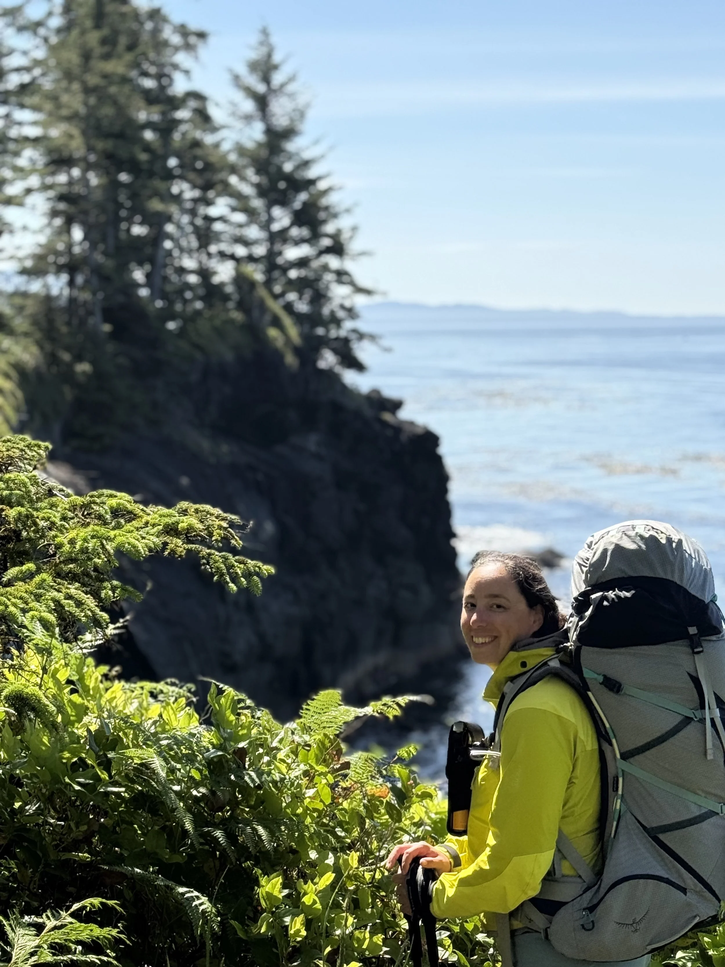
It was a fantastic 6 days and 5 nights on the 35 kilometers of the beautiful Nootka Trail. My hiking pal Ryan and I decided to tackle this treat after years of other adventures together. This trail has it all - beach walks, river crossings, cliff climbing, and forest bathing. From giant trees to tiny birds, the views on this trail are outstanding.
If you are looking to do the trail this year, hopefully this summary will be helpful for you to resource. As always, this is a summary of our own experiences, and you are always responsible for your own preparation and risk management.

Overall topics about our experience on the Nootka Trail 2025, July 1 through 6:
Nootka Trail Weather
We had almost the best possible weather on the Nootka Trail - it was sunny, between 18-23 decrees Celcius every day. The skies were mostly clear, with only a bit of cloud in the mornings and evenings. One morning there was the tiniest sprinkle of rain, but otherwise, the temps were perfect. At night, it probably didn’t drop much below 10 degrees. The wind, however, was a different story. The wind on days 2 and 3 of our adventure were strong from the north and west, which caused the wind to absolutely whip at us in the afternoons and early evenings. Since the trail walks north to south, the wind was mostly at our backs and sides (so again the best we could hope for), but it made setting up our tents a challenge for sure. In this case, my rain jacket was my best friend, because it gave me protection from the sun (big hood), and wind protection, but armpit venting to prevent overheating. Better than a sun hoodie for sure.
Speaking of sun hoodies… The reflection off the sun is amplifying the UV rays. Make sure you cover up! Although I covered my head, ears, and face, my thighs were exposed between my gaitors and my shorts. Wicked bad sun burn. I don’t generally hike with sunscreen on multi-day trips because I don’t want to deal with the sloppy grease, I prefer to cover up instead. But seriously - don’t forget this one.
It is well documented that rain can come at any time on the rainy West Coast. We packed an extra Sil Tarp with paracord, and pack covers just in case, but luckily, we didn’t need them. That being said, it would be well advised to plan for inclement weather every time.
Nootka Trail Map
There is a trail map published by John Baldwin that we purchased at our Air Nootka flight. It’s perfect and shows exactly what you need. I’m sure some folks will try to find online something to avoid buying it, but we recommend just to get it and support the work of the folks who make this trail happen. There is pretty good flagging, there are orange tree markers, and occasional pink and orange flags for most of the trail. Some parts are a little twisty-windy in the forest, so pay close attention. The section between Sunrise Beach and Sea Stack Beach has a lot of offshoot trails, and it’s easy to get turned around - pay attention to the flags, and if you lose them, backtrack and find them again. Bouys (often faded) mark the exit and entry points on the beaches, usually at the beginning and ends of the beaches.
Nootka Trail Safety
The weather we got was great - warm and sunny. This meant that the trail was less muddy and the rope climbs and cliffs were drier. This factor alone allowed us a great deal of fun and enjoyment of the cliff climbs. There are at least 6-8 cliff scrambles, ranging from 6 feet high to 16 feet high. You will need to climb and descend WITH YOUR BACKPACK, possibly in the rain. Most have some version of a marine rope for assistance, but the rope may be of varying condition after being tugged and dragged across jagged rock faces, and by the time you get to it, could be partially shredded. Without a doubt, this is one area where people may feel apprehensive and wished they had more preparation. Part of the work I do at Elios Health is prepare people to get in shape to feel confident in these circumstances. If you want to know more about physical fitness to tackle rope ascents, please contact me.
Nootka Trail Animals and Food Storage
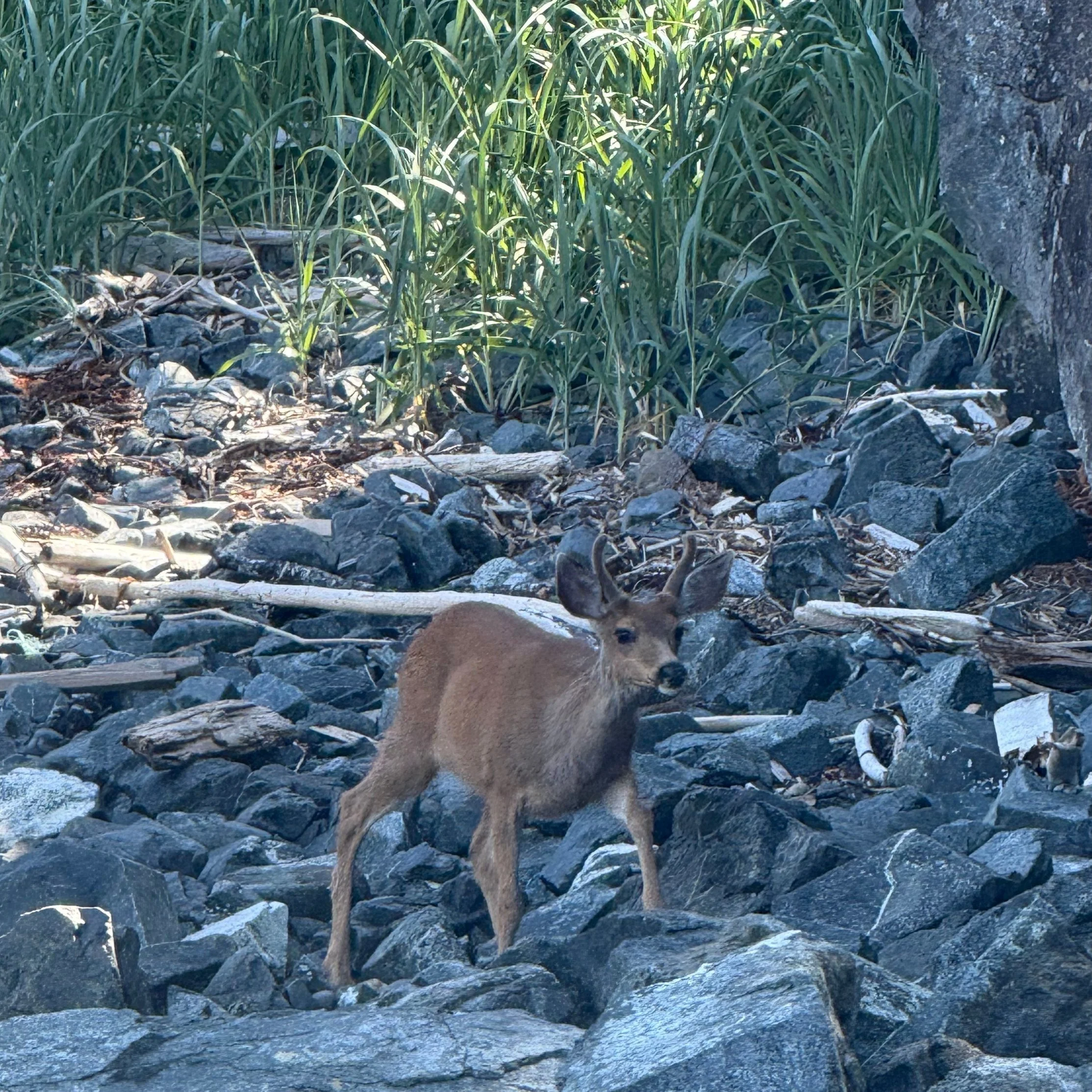
If you heard that it was a great place to see animals, you heard right. This is one reason we could have easily enjoyed one more day. We saw a wide range of creatures including:
1 wolf 🐺
1 deer 🦌
1 salmon (?) jumping up waterfall 🐟
1 small aquatic rodent
2 bears 🐻
2 herons (crane)
3 otters 🦦
4 snakes 🐍
Many seals 🦭
Many bald eagles 🦅
Many starfish ⭐
Many bumblebees
Many sea anemones
Lots of humming birds
Many other birds, including variations of pipers, swallows, sand birds, ravens, and more we couldn’t identify.
For the most part, we were able to be very still and just allow the animals to go on by. In the case of the bears, we gave them a wide berth by travelling on the tidal shelf (they were foraging on the shore at low tide). To protect our food we used a Bear Vault - far easier than trying to hang our food - and we tucked it way downwind from our camp each day. Generally speaking, the animals just want to be left alone, which we were happy to oblige. Many other folks saw whales - we weren’t so lucky on that, but we did see a wolf and a deer!
Human Impact: Wilderness Camping on the Nootka Trail
Every year, the trail gets busier. We probably encountered 20 different people just in our 6 days. A few years back, there were some green toilets installed, but now they are all full. At the time we went, there were two pump outhouses (waste diversion toilets): Third Beach and Beano Creek. The other remaining green toilets we saw (Third Beach, Calvin Falls, Manquina Point) were very/over full. The rest of the places, you need to dig and bury. Please dig deep and far away from water sources (for all our sakes). Pack out the TP, or if fires are permitted, burn it. Fires are not Leave No Trace (LNT), but seem to be common and indicated in some sources as acceptable. Please, please check any local fire bans, and use already-created pits, and/or go below the tide line.
Landing Fee for the Nootka Trail
The Nootka Trail is on the unceded territory of the Mowachaht/Muchalaht First Nation. The hiking fee is $75.00, and includes the use of the facilities. It can be paid in cash or online in advance. We paid in cash because the website wasn’t accepting cards at the time of booking.
Getting to Nootka Trail
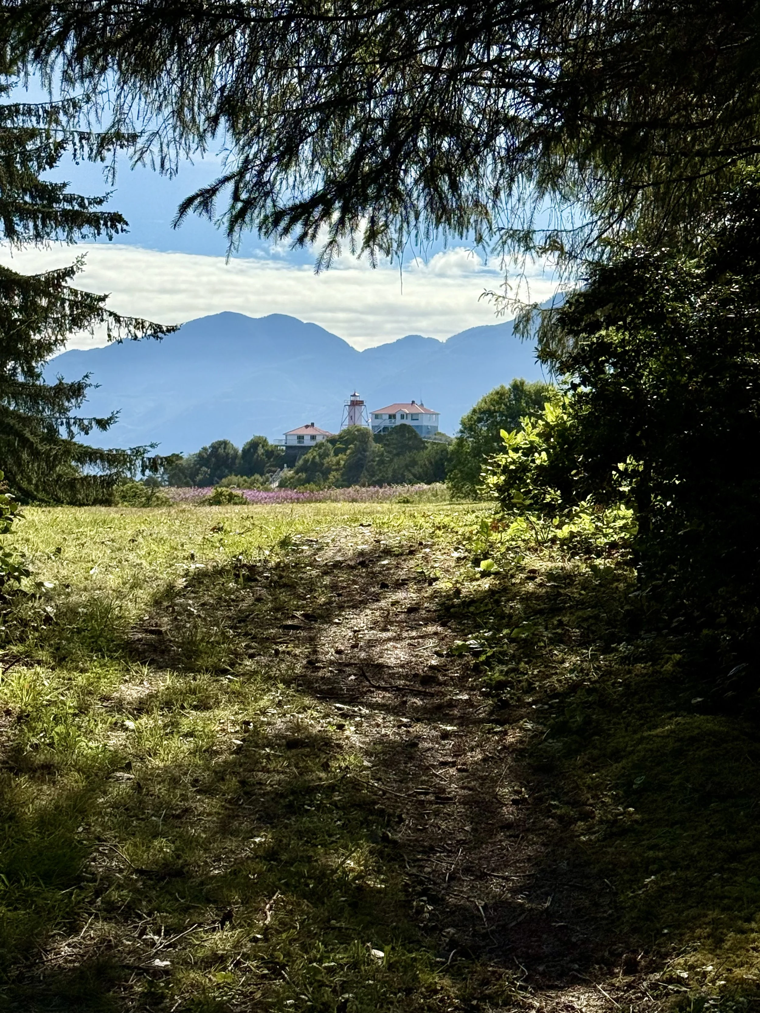
We took the Air Nootka Flight from their location south of Gold River to Louie Lagoon, and were picked up at the dock at Friendly Cove. The service was efficient and safe and saved us a lot of time with planning and making the water taxi/ferry. I was very impressed with their kind, patient and friendly service, especially with my million questions. Thanks to Tyra, Scott, and Angela! We are aware that there are water taxi options and ferry options. You may wish to explore this if you are more time flexible or on a budget.
Tide Crossings and Swimming on the Nootka Trail
Tide crossings (also known as tide problems) are one of the most intimidating things about this hike if you haven’t done a lot before or if you are new to water crossings. It’s easy to say “carry a tide chart” but it’s another to understand what that means. The MAP outlines where the water crossings are. You then need to check, not only are the tides of that day, but how they relate to the highest and lowest possible tides. You also then need to plan your hike to be able to ensure you arrive at the right time of day to be able to cross. The easiest way to plan is to prepare for more stops, stay longer, and then you have options in case you get stuck. What seemed to me like “moderate tides” were actually pretty low for the time of month and year, and we were able to cross at low and moderate quite comfortably. According to the map, the trail is designed to be able to be completed with up to 2/3 tide levels, with some overland crossings in emergencies. Here is the tide chart.
Regarding swimming, we didn’t swim at all except in the tidal lagoon just before Seastack Beach. It was just too cold, and the wind could really turn a warm afternoon into a cold evening. Some folks swam in the pool of Calvin Falls, and we saw no one swim in the ocean. The advice we received was to avoid it due to currents, and so we did. Maybe there are other people who know better.
Water Quality on the Nootka Trail
We carried a water filter, and had no issues by following the instructions on other blogs. The guideline is: the higher, bigger and faster flowing the river, the less brackish the water. The smaller and more connected to the ocean, the more brackish, and in that case, go far upstream. We were a little nervous at Beano Creek, but collected upstream when the water was flowing and the tide was lower, and had no issues. When the tide came in in the morning, the creek became a lagoon, and no water was moving. We did not take water then, instead opting to collect water at Callicum Creek a few kilometers away. The water at Sunrise Beach came from a little bog, and was brownish, and was still brownish when it went through the filter, but tasted just fine and had no issues. Same with the water from the creek at Sea Stack Beach.
Get Ready for the Nootka Trail
Are you ready to tackle the Nootka Trail, but have more questions? As Sports Acupuncturist, a huge portion of my work is non-needle consultation. I provide training plans and preparation strategies for hikers, climbers, and outdoor athletes. If you would like to work with me, you can book directly HERE, or email me.